This initial portfolio of imagery features striking visual perspectives of regions spanning from southern Europe to the polar extremes. Among the first batch are stunning views of Italy, the Canadian Arctic, and the Caribbean, all captured by the spacecraft’s advanced ocean and land color instrument. Alongside these visual portraits, the satellite has also delivered precise scientific measurements detailing the height of the Greenland ice sheet and the sea surface, gathered directly from its onboard synthetic aperture radar altimeter.
Sentinel-3C stands as the third satellite in the ongoing Sentinel-3 series, engineered to pick up the mantle and seamlessly continue the mission’s critical, long-term responsibility of delivering comprehensive environmental data. This continuous stream of information remains essential for a wide-ranging spectrum of ecological, maritime, and atmospheric applications across the globe.
To achieve its comprehensive monitoring goals, the Sentinel-3 satellites carry an identical, highly sophisticated suite of scientific instruments designed to systematically measure Earth’s oceans, landmasses, cryosphere, and atmosphere with unprecedented accuracy. Over the world’s oceans, Sentinel-3 plays a vital role by continuously measuring the temperature, color, and height of the sea surface, as well as tracking the thickness of sea ice. These metrics provide invaluable support for monitoring marine pollution, tracking the devastating expansion of marine heatwaves, and understanding larger global climate shifts.
Meanwhile, over terrestrial landscapes, this innovative mission takes on the heavy lifting of monitoring droughts and tracking active wildfires. It maps changing land-use patterns, checks the health and vigor of global vegetation, and measures the fluctuations in the height of inland waterways, including rivers and lakes, alongside polar ice sheets.
Despite these early successes, the European Space Agency emphasizes that the mission is still in its infancy. ESA specialists are currently in the midst of commissioning Sentinel-3C for operational service—an intricate, highly technical process that will require approximately five more months of rigorous calibration and testing. However, after spending a mere two weeks in orbit, the spacecraft’s initial images and telemetry data already showcase an instrument on the fast track to excellence.
A Visual Tour of Our Dynamic Planet
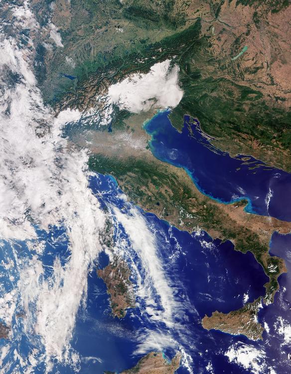
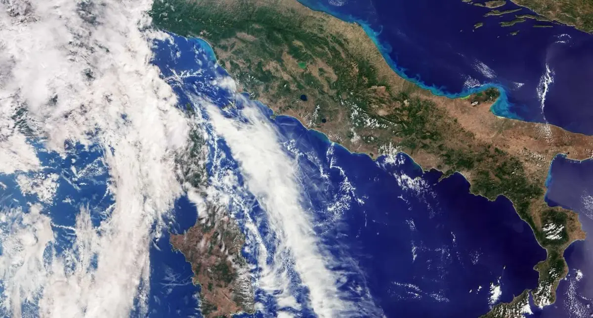
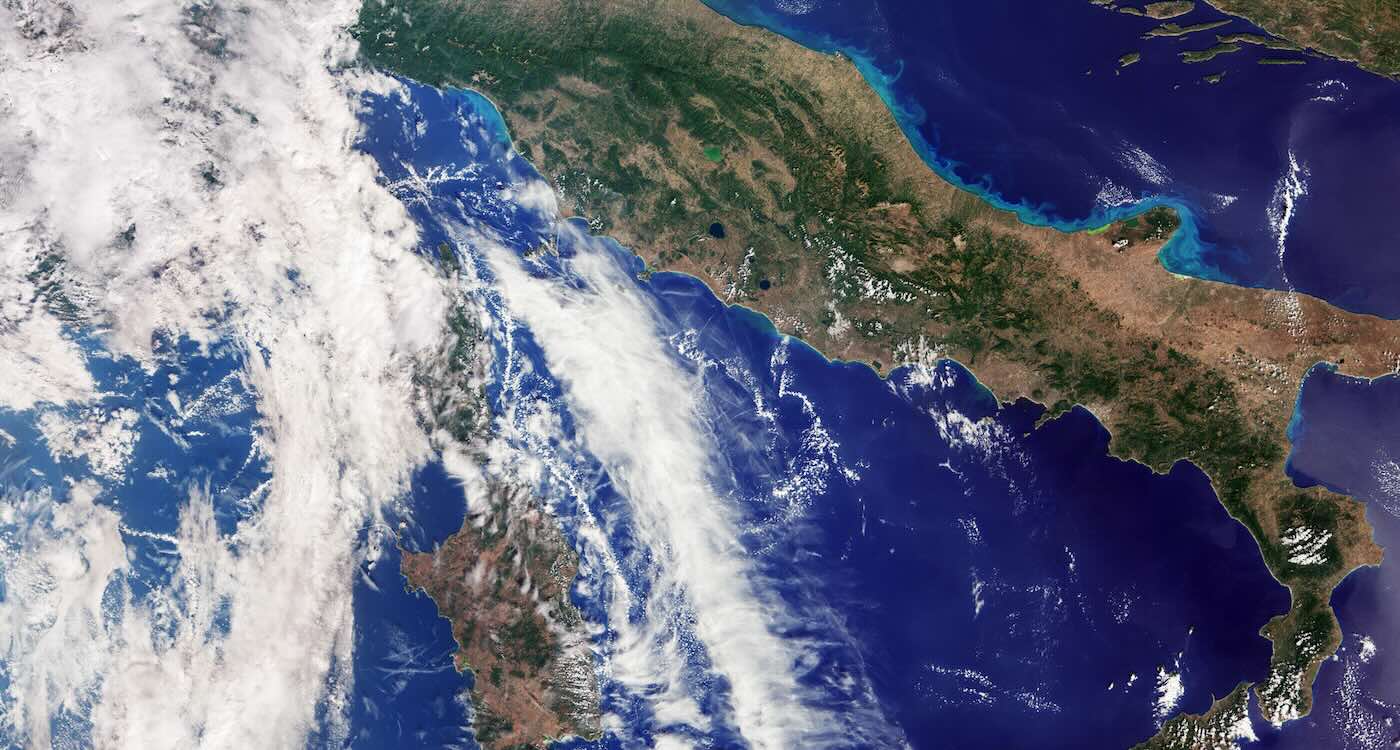
The first major highlight from this initial data drop is a striking natural-color view captured by the ocean and land color instrument. The image reveals the Italian peninsula in stunning detail, stretching continuously from southern Germany in the north all the way down to Sicily and the sparkling blue expanse of the southern Mediterranean. The clarity of the photograph allows observers to trace mountain ranges, agricultural expanses, and coastal water boundaries with remarkable definition.
Following this European portrait is a second remarkable image, captured on September 30th, which turns its gaze toward the remote expanses of the Canadian Arctic Archipelago located west of Greenland. In this starkly beautiful scene, vast stretches of snow- and ice-covered islands dominate the landscape. Rugged coastlines, deeply carved fjords, and exposed rock formations intersect to create intricate, natural geometric patterns across the frozen terrain.
Because this image was captured during this particular time of year, seasonal sea ice is naturally at an annual minimum. Even so, the satellite’s sensitive optics clearly capture fractured ice floes drifting across the dark, open water of the northern seas.
As the European Space Agency moves forward with the remaining months of the commissioning phase, scientists anticipate that Sentinel-3C will soon join its predecessors in delivering a continuous flow of vital Earth observation data. By pairing high-definition visual imagery with rigorous scientific measurements, the satellite will continue to deepen humanity’s understanding of a changing planet, providing researchers and policymakers with the tools necessary to protect and monitor the natural world for years to come.